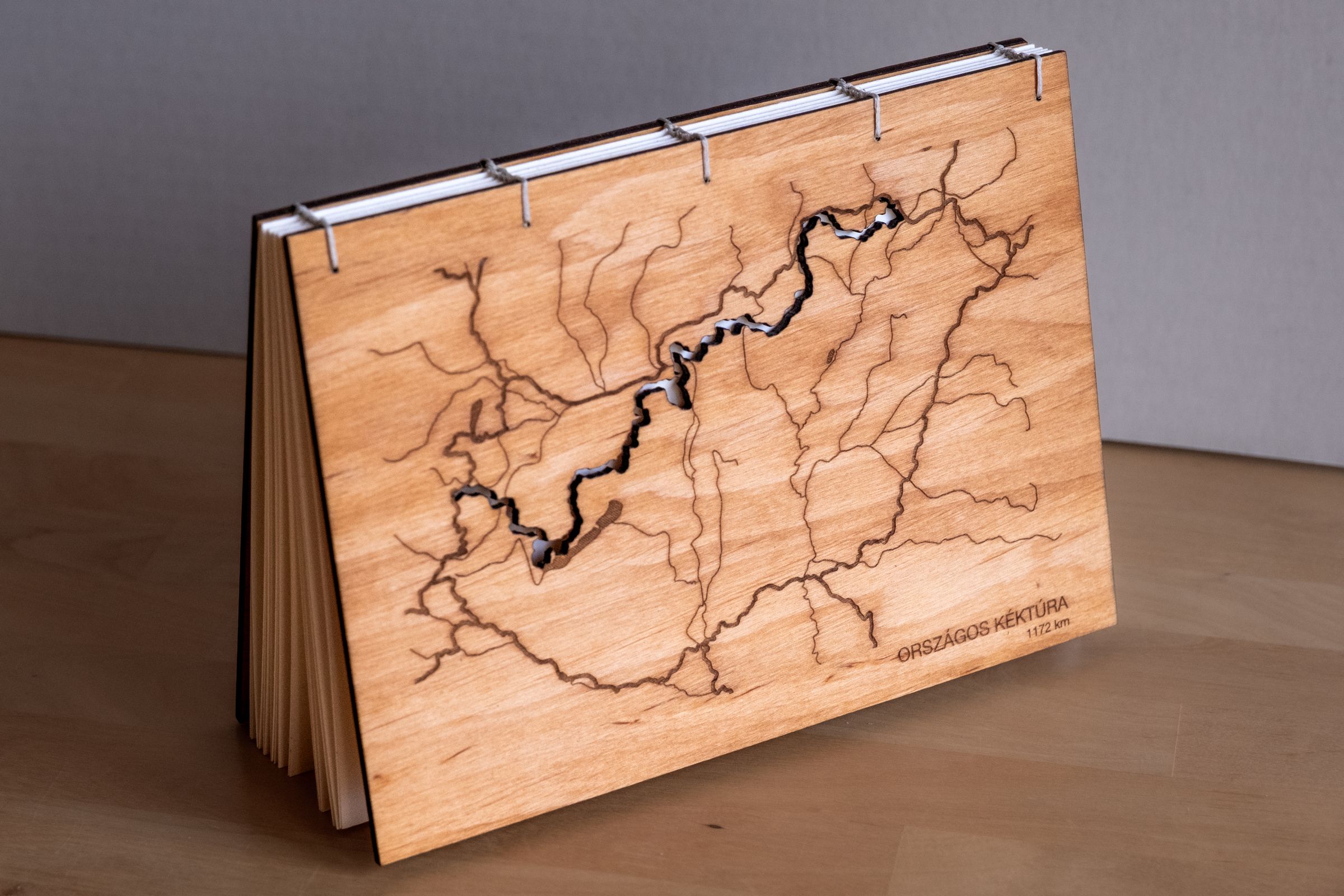
I made a custom photo album about the Hungarian Blue Trail, as a gift for friends I walked it with. Handmade gifts always bring me a special kind of excitement: the freedom to explore and play, while still designing for someone else and moving toward a real deadline. The best part is that the giftee can stay on my mind the whole time.
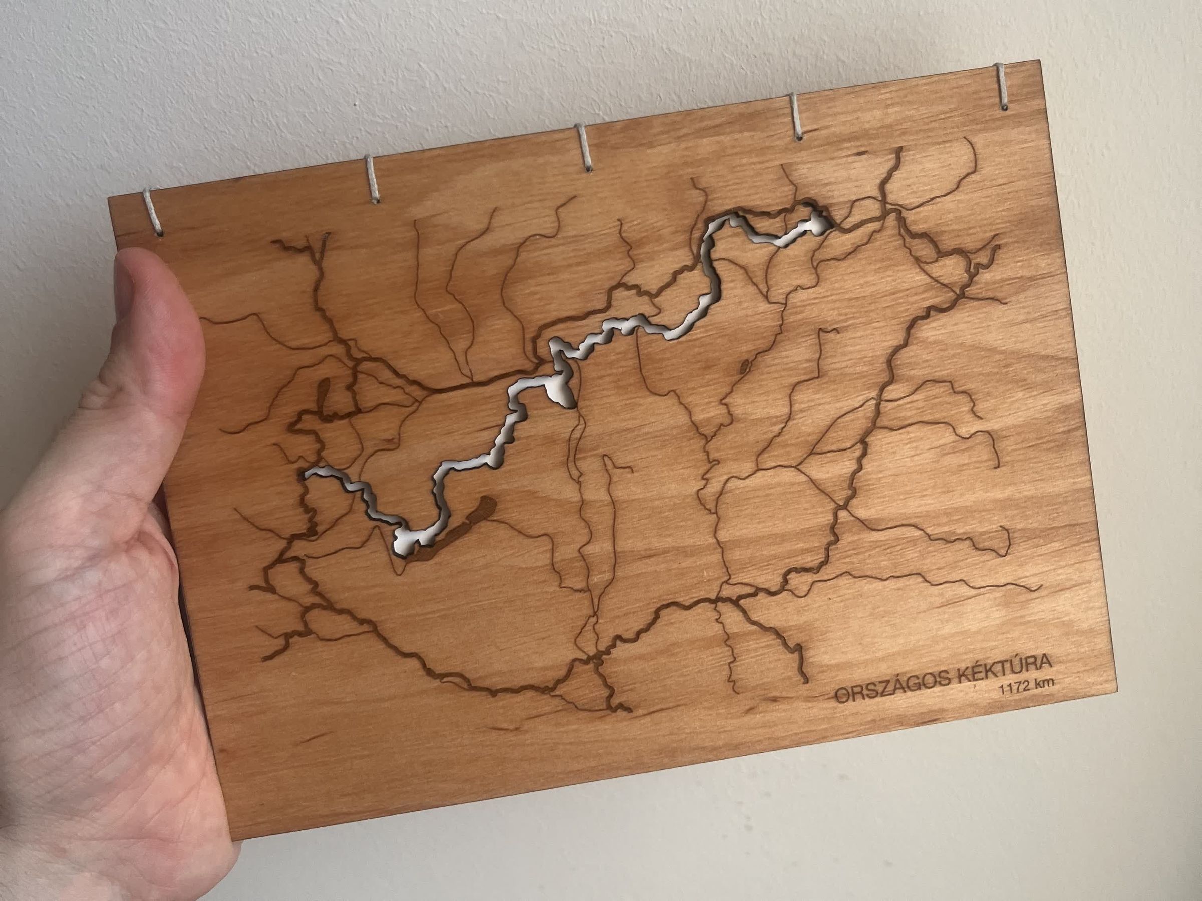
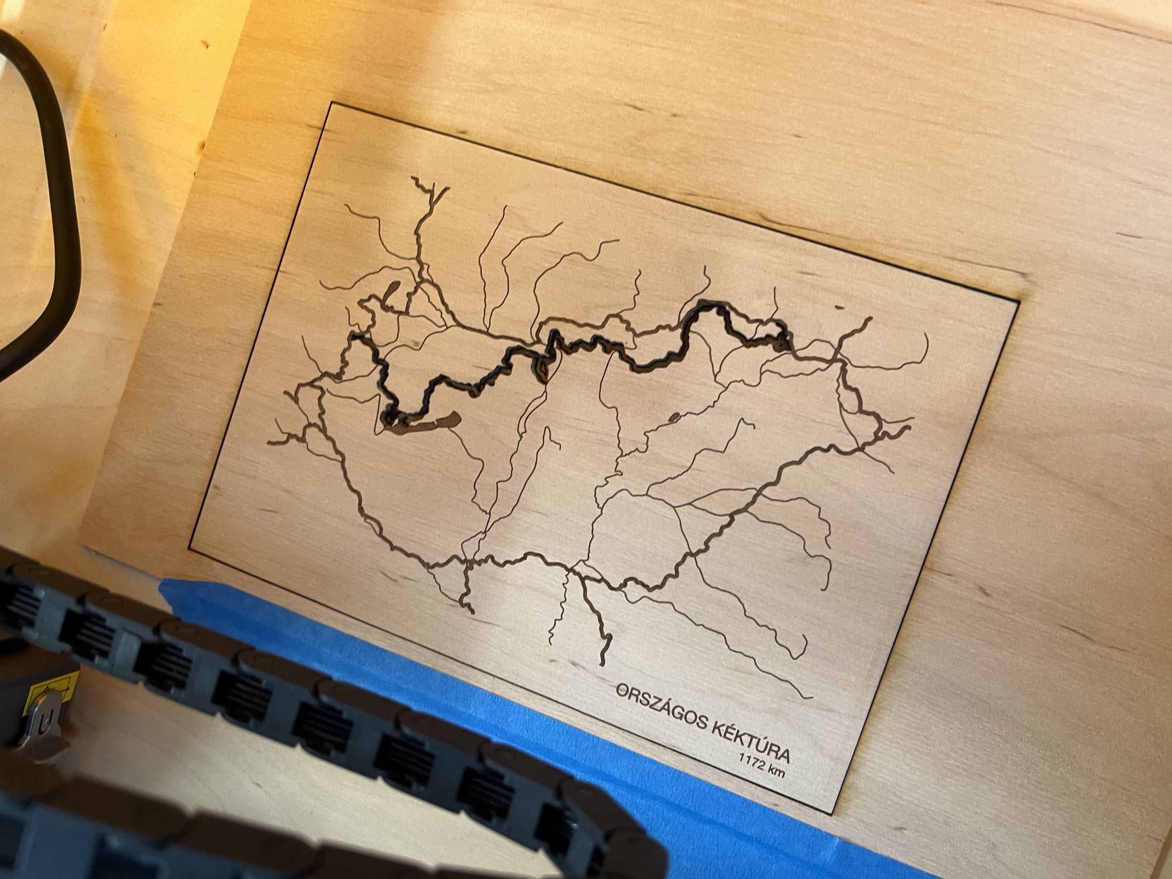
One day this was a note and a rough sketch in my notebook: a wooden cover, the trail cut into a map. The next day I could hold that idea in my hand. That transition still feels like wonder every time.
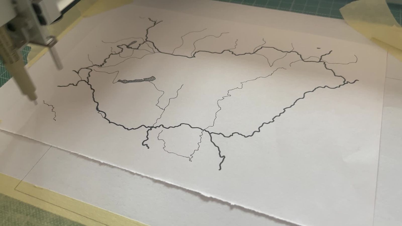
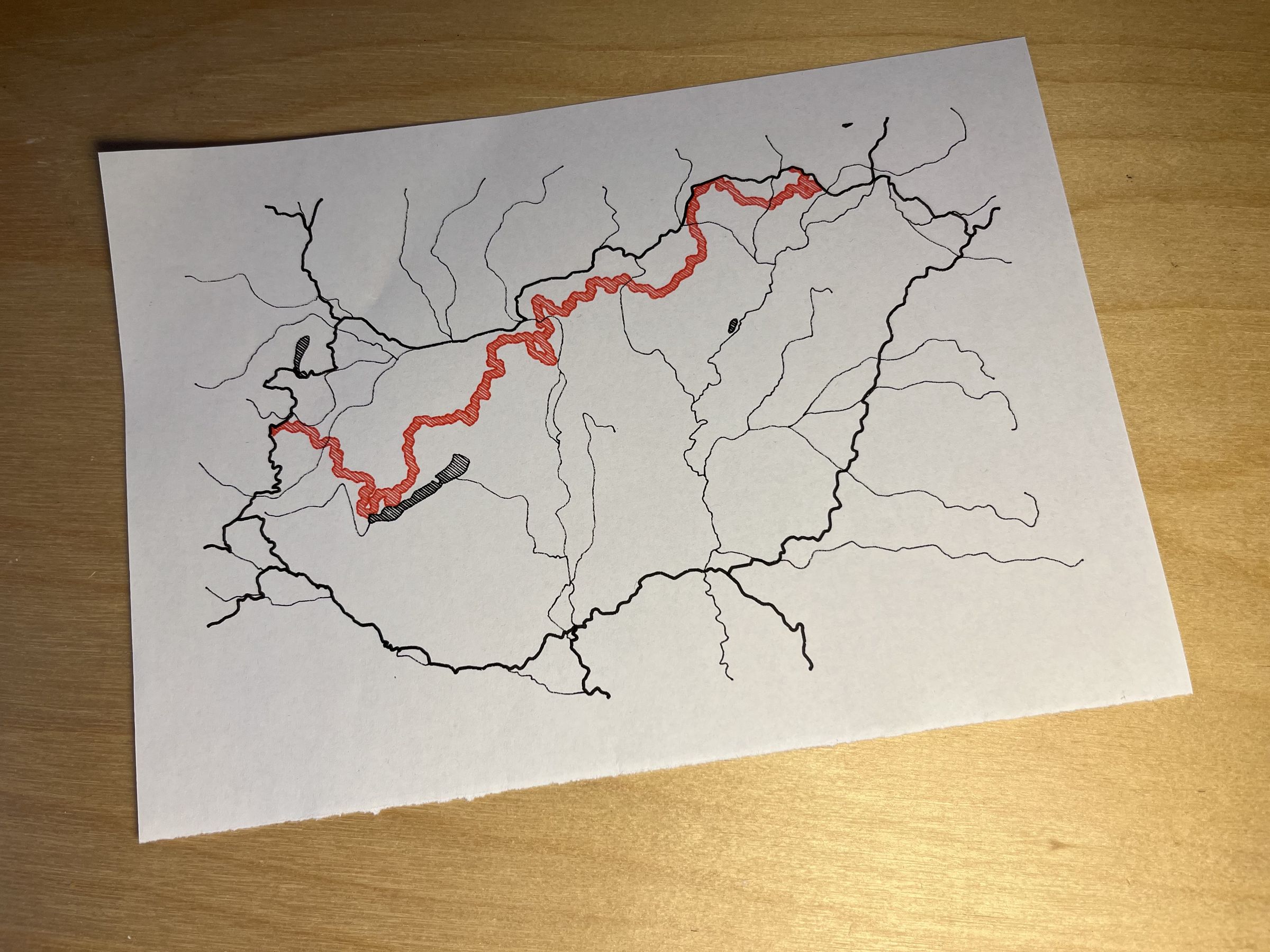
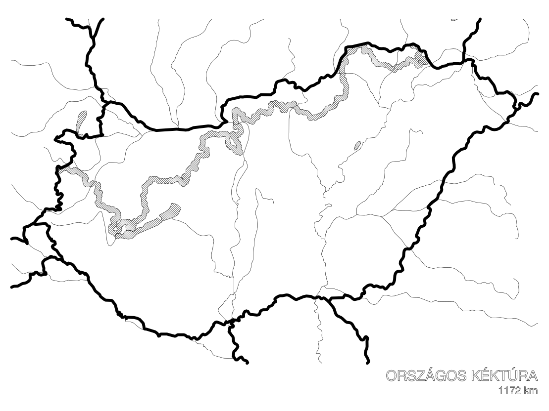
The map came from a script I created. It takes a trail in GPX format and merges it with Natural Earth map data to produce vector files for fabrication machines. I checked the result by running test plots on my pen plotter and adjusted from there: how to represent water bodies, what to do with orphaned river and border segments, how to cut the trail while leaving landmarks readable. I still enjoy the fast iterative loop of turning data into something visual with code.
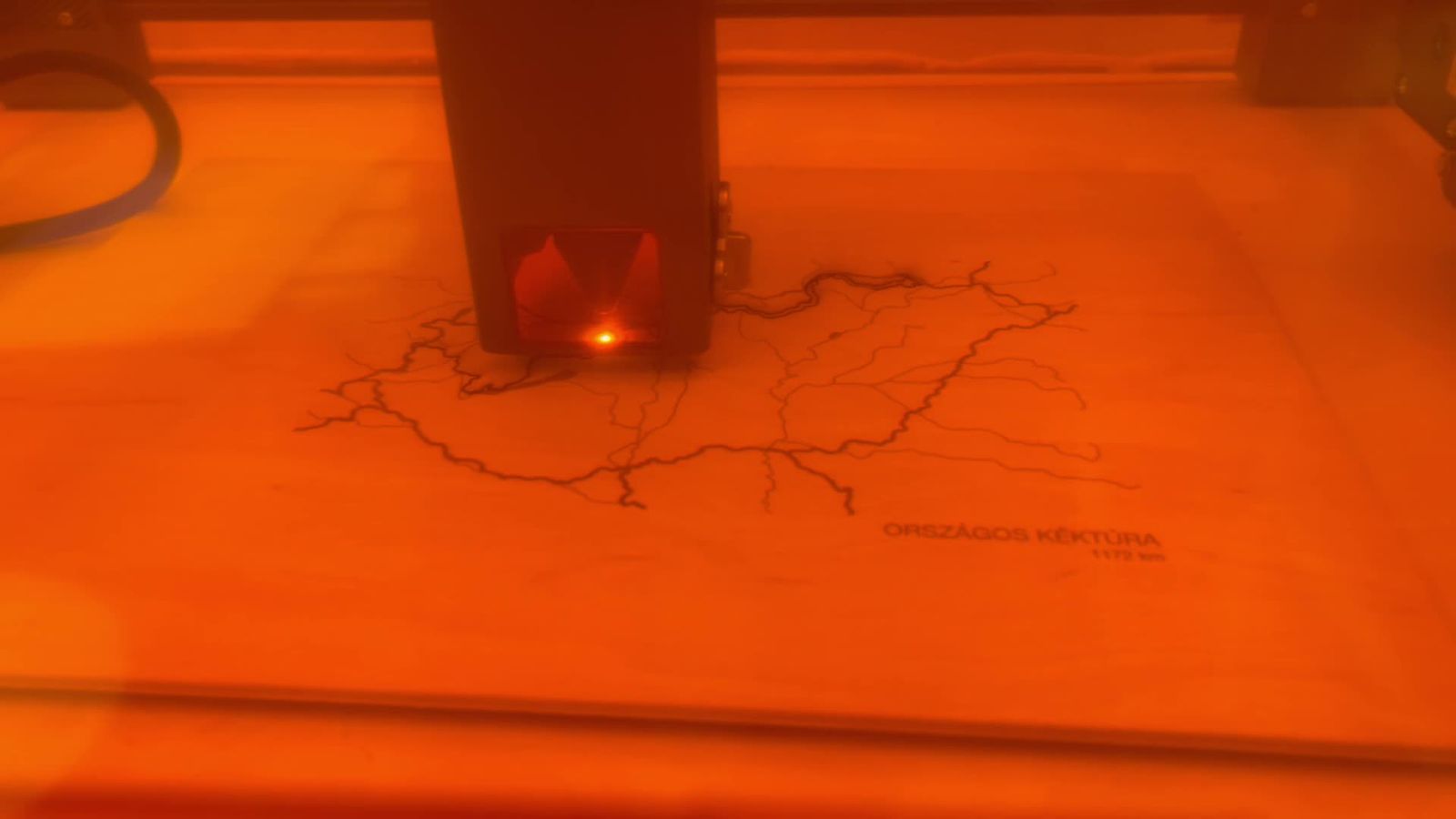
When the composition felt right, I borrowed a laser from a friend (thank you, balassa_wood!) and tried engraving for the first time. After a few videos about lasers and LightBurn, I started running material tests and worked toward the final cover step by step. The amount of shared knowledge available online still surprises me every time. I feel like I'm never alone when trying to learn something.
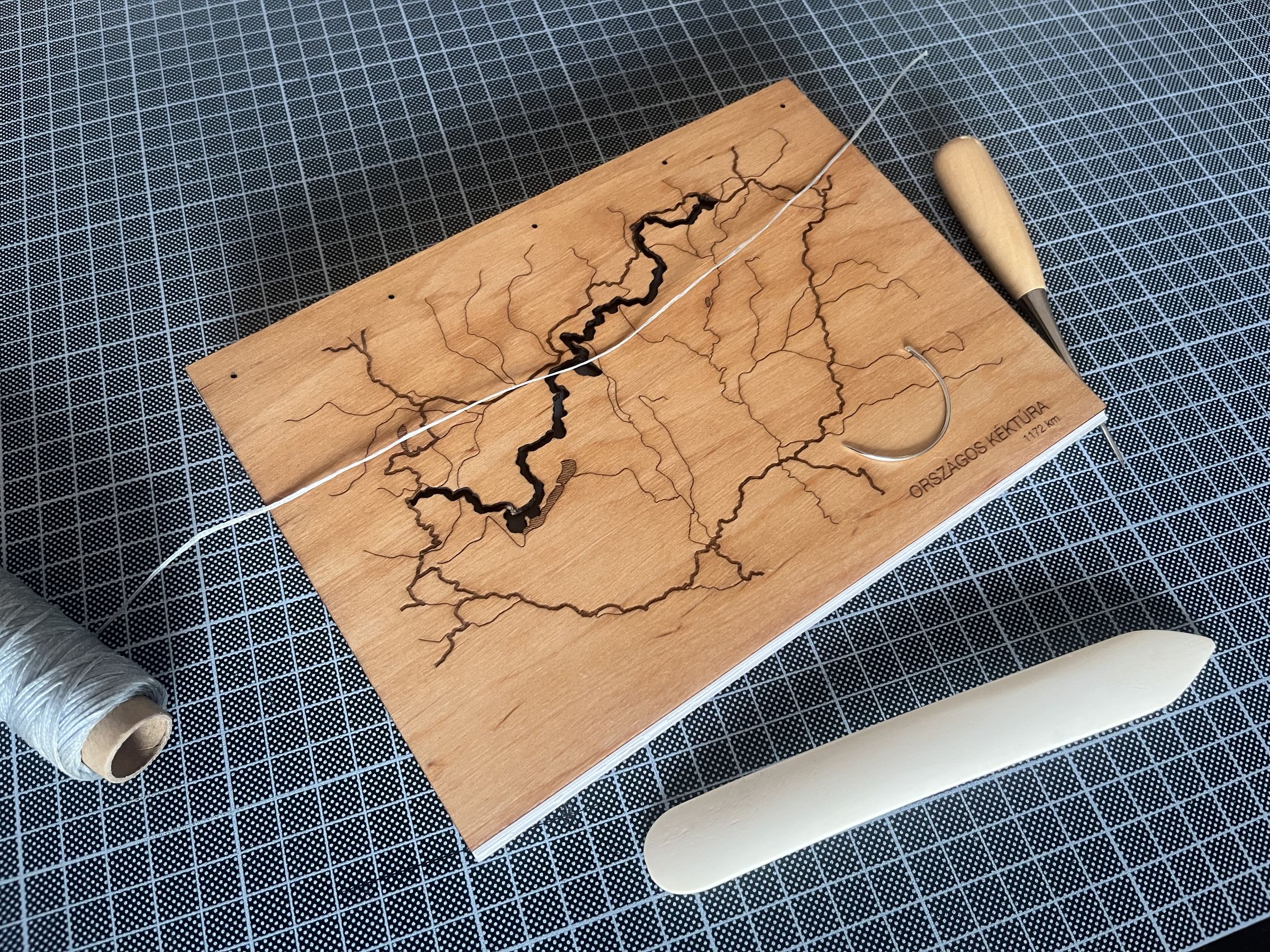
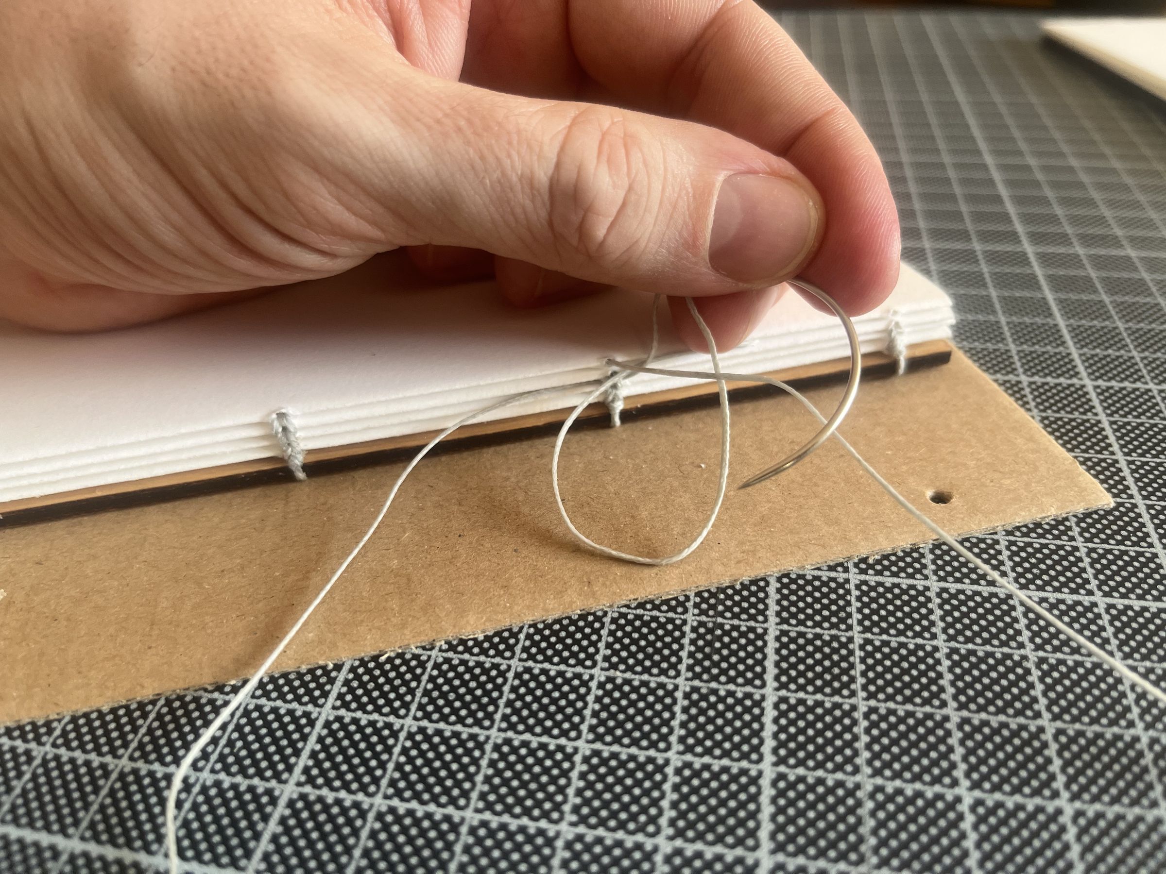
The binding was already familiar territory, more meditative than exploratory. I folded the pages, stitched the spine with waxed thread, and trimmed the edges. Watching it come together was so satisfying.
Photographing the finished album felt like closing the loop. An idea that started as a sketch, moved through code, machines, and my hands, and became something I could present with a happy heart.
If you want to recreate something similar:
- The fabrication-ready vector files are available as digital downloads. You can contribute by pledging any amount that feels right, the files are linked regardless in the description.
- If you are more into tinkering, the gpx2fab script I created takes a trail in
.gpxformat and merges it with available map data of a specified country. I tested it on a few through-trail and country combinations I know and it holds up, but note that it is not a polished product yet. I can see myself returning to this later, as visualising data and digital fabrication can still make me very excited. - The covers are 4mm birch plywood, cut and engraved on a 20W diode laser operated using LightBurn. Cut-through was 350 mm/min at 100% power, engrave was 11,000 mm/min at 60%.
- If you want to try your hand at Coptic binding:
Let me know, if you create something similar, I would really like to see it!